
Okay. So I didn't post my miles for nearly a month and a half. So kill me.
.
While looking through this, there are two numbers to keep in mind: the actual distance around the state of Texas (2842 miles according to a Texas textbook) and how much I have actually covered (my total miles are probably in the 1600 range). I haven't sat down and added everything up, but I'm confident my ballpark estimates are close nonetheless.
.
Miles first, this time, then pictures and journal entries and thoughts. Enjoy!
.
Day 186: Near Turkey, 10 miles
Day 187: Parnell Station, 22 miles
Day 188: Intersection of Ranch Rd 1619 and County Rd K, about 20 miles
Day 189: Hwy 83 south of Wellington, about 15 miles
Day 190: Hwy 83 north of Wellington, about 16 miles
Day 191: Hwy 83 south of Shamrock, about 15 miles
Day 192: Hwy 83 north of Shamrock, about 15 miles
Day 193:Hwy 83 north of Wheeler, about 13 miles
Day 194: Canadian, about 28 miles
Day 195: Zero day in Canadian
Day 196: Marvin Lake, about 14 miles
Day 197: Higgins, about 25 miles
Day 198: Lipscomb, about 20 miles
Day 199: FM 1454 south of Follett, about 20 miles
Day 200: Top-Right Corner of the Texas Panhandle, about 16 miles
Day 201: Old Railway Path which parallels Hwy 15, about 16 miles
Day 202: Past Booker, about 18 miles
Day 203: Perryton, 15 miles
Day 204: Waka, 17 miles (I walked the first mile in Perryton looking for the church below.)
Day 205: Zero day in Waka
Day 206: Beyond Hansford, about 17 miles
Day 207: Intersection of Farm Rd 1262 and FM 2535, about 17 miles
Day 208: Texhoma, about 26 miles
Day 209: FM 2677 (I walked due west of Texhoma and came down), about 21 miles
Day 210: Northwest of Stratford, about 8 miles
Day 211: High Lonesome, about 21 miles
Day 212: Thompson Grove, about 19 miles
Day 213: Top-Left Corner of the Texas Panhandle, about 18 miles (9 to Texline, 8 to the corner, and 1 bouncing between the corner marker and the tri-state marker)
Day 214: Hwy 87, about 16 miles
Day 215: Dalhart, about 28 miles
Days 216 to 218: Three zero days in Dalhart
Day 219: North of Hartley, about 14 miles
Day 220: Channing, about 15 miles
Day 221: Hwy 385, about 15 miles
Day 222: Vega, about 20 miles
Day 223: South of Adrian, about 18 miles
Day 224: Hwy 214, about 20 miles
Day 225: Hwy 214, about 19 miles
Day 226: Beyond Friona, about 16 miles
Day 227: Hwy 60, about 22 miles
Day 228: Past Lariat, about 13 miles
Day 229: Muleshoe, about 12 miles
. . ..
While looking through this, there are two numbers to keep in mind: the actual distance around the state of Texas (2842 miles according to a Texas textbook) and how much I have actually covered (my total miles are probably in the 1600 range). I haven't sat down and added everything up, but I'm confident my ballpark estimates are close nonetheless.
.
Miles first, this time, then pictures and journal entries and thoughts. Enjoy!
.
Day 186: Near Turkey, 10 miles
Day 187: Parnell Station, 22 miles
Day 188: Intersection of Ranch Rd 1619 and County Rd K, about 20 miles
Day 189: Hwy 83 south of Wellington, about 15 miles
Day 190: Hwy 83 north of Wellington, about 16 miles
Day 191: Hwy 83 south of Shamrock, about 15 miles
Day 192: Hwy 83 north of Shamrock, about 15 miles
Day 193:Hwy 83 north of Wheeler, about 13 miles
Day 194: Canadian, about 28 miles
Day 195: Zero day in Canadian
Day 196: Marvin Lake, about 14 miles
Day 197: Higgins, about 25 miles
Day 198: Lipscomb, about 20 miles
Day 199: FM 1454 south of Follett, about 20 miles
Day 200: Top-Right Corner of the Texas Panhandle, about 16 miles
Day 201: Old Railway Path which parallels Hwy 15, about 16 miles
Day 202: Past Booker, about 18 miles
Day 203: Perryton, 15 miles
Day 204: Waka, 17 miles (I walked the first mile in Perryton looking for the church below.)
Day 205: Zero day in Waka
Day 206: Beyond Hansford, about 17 miles
Day 207: Intersection of Farm Rd 1262 and FM 2535, about 17 miles
Day 208: Texhoma, about 26 miles
Day 209: FM 2677 (I walked due west of Texhoma and came down), about 21 miles
Day 210: Northwest of Stratford, about 8 miles
Day 211: High Lonesome, about 21 miles
Day 212: Thompson Grove, about 19 miles
Day 213: Top-Left Corner of the Texas Panhandle, about 18 miles (9 to Texline, 8 to the corner, and 1 bouncing between the corner marker and the tri-state marker)
Day 214: Hwy 87, about 16 miles
Day 215: Dalhart, about 28 miles
Days 216 to 218: Three zero days in Dalhart
Day 219: North of Hartley, about 14 miles
Day 220: Channing, about 15 miles
Day 221: Hwy 385, about 15 miles
Day 222: Vega, about 20 miles
Day 223: South of Adrian, about 18 miles
Day 224: Hwy 214, about 20 miles
Day 225: Hwy 214, about 19 miles
Day 226: Beyond Friona, about 16 miles
Day 227: Hwy 60, about 22 miles
Day 228: Past Lariat, about 13 miles
Day 229: Muleshoe, about 12 miles
. . .
 Taking Back the Land, Collingsworth County, Day 190
. . .
Day 190: Hiking sticks gone! After looking around the library, I found one broken, half in the garbage can and half on the ground.
.
Day 191: Woke up in the middle of the night and peed off to the side of my sleeping area; got a bag strap and my mat! Ah! I sprinkled sand on everything. [Note: I literally urinated while lying down. When it was cold out, I hated getting up and losing my warmth. I acknowledge the gross factor here, but before you judge, go spend a night out in the cold.]
. . .
 Mural, Shamrock, Wheeler County, Day 192
. . .
Day 194: Hiked to Canadian ~28 miles; tough walking against the wind ... went to a meal at the Cattle Exchange with Tamera Julian, Director of the Community Development Center, her sister, parents John & Lee Ann, and family friend Dawn Webb. Lots of questions! [Tamera, whom I had spoken with earlier, had kept the entire party a secret from me, so having dinner at a full table was an unexpected surprise. The evening with her family and Dawn was the perfect end to a rough day. Then Tamera put me up in a Best Western for a couple of nights!]
. . .
 First Day at School by Norman Rockwell, The Citadelle Art Foundation, Canadian, Hemphill County, Day 196
. . .
Day 196: Went to Citadelle Art Foundation in morning; met Sue and Wendie. [Such a plain entry for such a great place! Wendie is the Director and is rounding the end of the foundation's first year. Given what I saw, she's done a great job. Sue Cox volunteers once a week at the foundation and gave me the run of the place. The collection is wide and varied with paintings, sculptures, photos, even a cross blessed by a pope. These three shots are my favorites in the collection.]
. . .
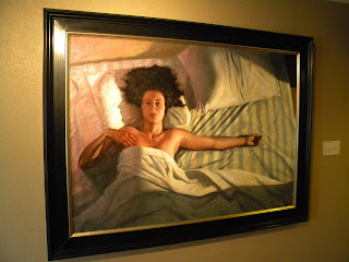 Sweet Sixteen by Christian Vincent, The Citadelle Art Foundation, Canadian, Hemphill County, Day 196
. . .
. . .
 Twins by Jono Rotman, The Citadelle Art Foundation, Canadian, Hemphill County, Day 196
. . .
Day 196: On the way met Tray Webb, brother of Dawn; he stopped and shook my hand ... When I finally reached Marvin Lake, I met Sue again from the art museum! She offered me a night in; I accepted ... had some really nice conversations with Sue and Lonnie Cox, both in the ranching business.
. . .
Day 198: In Lipscomb. Tiny place. Staying at Naturally Yours thanks to Debby and Jan.
 High Plains Recycling, Lipscomb County, Day 199
. . .
Day 199: I met Boone Tyson of Tyson Ranch. He was youngish, red pick-up, backward cap. I complimented the panhandle, and he said simply "It's home." We chatted a bit, then he took off. In leaving he said, "I will be praying for you."
.
Before meeting Boone, I met another man who stopped to see if I needed a ride. But there was more. He invited me to a meal and a prayer group. I turned all three down. I tried to explain I was in the middle of a project, but he couldn't hear me where his mind was. I thanked him, and he took off. Later, he passed with his wife and daughter and offered again, this time only mentioning the food. I declined, smiling. They looked like they were ready to adopt me.
.
The difference between these encounters is stark. Boone asked my name, gave me his, and shook my hand. We were equal. The other fellow just saw me as a bum to be saved.
. . .
 The Panhandle's Top-Right Corner, Lipscomb County, Day 201
. . .
Day 201: Woke up near corner; hopped fence and found marker. [Back in Follett, everyone was asking me about the marker. Men who'd lived there their entire lives had never seen it. My little expedition got them all excited about it.]
. . .
 Going Rates, Booker, Lipscomb County, Day 202
. . .
Day 203: Frost again! Everything covered. ... Hiked into Perryton; scared up several pheasants and rabbits; took a lot of breaks, too; problem? ... I went to the library and posted a blog; bought a book by Plato for 25 cents; wisdom is cheap. [Donnie Dendy, whom I met in Lipscomb, put me up in his future home this evening.]
. . .
 Key Heights Baptist Church, Perryton, Ochiltree County, Day 204
. . .
Day 204: Wild goose chase; in Perryton trying to find my old pastor's old church before he came to Corpus; First Baptist Church was a bust; the secretary was scared even. ... Accidentally found Donnie at a restaurant with two women; one had known of my old pastor, so I was able to find the above church!
. . .
 Batman Grains, Ochiltree County, Day 204
. . .
Day 205: Nice night under a warm Ecuadorian wool blanket. [For two evenings, I was hosted by Mike Ladd of Waka. He's a former Peace Corps Volunteer, so we exchanged a ton of stories. The blanket was a Peace Corps byproduct.]
. . .
 Windmills, Spearman, Hansford County, Day 206
. . .
Day 206: Walked to a small canyon; Bud the dog followed me from a few miles back. [Several dogs have followed me along my trek, for a mile or two or three. Most turn back after a bit, but Bud stayed true. At my campsite, he dug up a rat for dinner, ate it and puked it up in the middle of the night. Bud stayed with me underneath my tarp, growling from time to time throughout the night. In the morning, I gave him some jerky, called his number on his tag, and his mom came and picked him up. She told me that collies can be very protective.]
. . .
 My First Snowman in Texas, Hansford County, Day 206
. . .
. . .
 Grandpa's Tree, Hansford County, Day 208
. . .
. . .
 Target Practice, Sherman County, Day 208
. . .
. . .
 Five Miles to Go, Sherman County, Day 210
. . .
. . .
 Bloody Toe, Sherman County, Day 210
. . .
Day 210: I'm getting the homeless vibe again. My waitress could hardly keep a straight face, part giggly, part embarrassed. Ah, to be known... [I had camped out in the snow and wind, so I probably didn't look too great. Take my feet, for example. I walked into Stratford in the shoe you see above. My toenail on my foot had buckled to the pressure of walking everyday. As a result, I bled a lot, straight through my sock and shoe. I later went to a laundrymat and washed the whole thing.]
. . .
 I'm Sure You Will, Stratford, Sherman County, Day 210
. . .
. . .
 Where the Antelopes Play, Rita Blanca National Grasslands, Dallam County, Day 211
. . .
Day 212: Wind! The wind actually started last night as I was settling in; lasted all night and all day. Tore apart my tarp in different spots. Wrecked the Hilton [My tarp set-up had been extra-spacious that evening, and I called it the 'Hilton.'], though the stakes held. Stayed in bed till 10:30am!
. . .
 The Builder, Dallam County, Day 213
. . .
Day 213: [The above was on an abandoned well in the Kiowa National Grasslands in New Mexico, just north of Texas in the northwest of the panhandle. I was looking all over for that corner marker and stumbled upon this well. It is nowhere near the corner, but what a neat thing to see.]
. . .
 The Panhandle's Top-Left Corner, Dallam County, Day 213
(Close-up below)
. . .
. . .
 41.19 Feet to Corner, Dallam County, Day 213
. . .
. . .
 The Other Marker, Dallam County, Day 213
(Tri-State Marker of Texas-Oklahoma-New Mexico)
. . .
. . .
 Sunset on the Top of Texas, Dallam County, Day 213
. . .
. . .
 Dalhart Consumers, Dalhart, Dallam County, Day 215
. . .
Day 215: Finally made it Dalhart. After meandering with a pint of ice cream in hand, I made it to downtown and met my couchsurfing host Nate French. I also met his dog Mr. Lambert who was wearing a glittering collar and a blue shirt that read Cool Pups in sequins. We talked, I cleaned up, and we went out to eat. Nate also gave me an impromptu tour of the town. ... Great host, great guy, nothing but helpful and nice and giving.
.
Day 220: In trying to find Randy's yard [where I was going to be camping for the evening], I met Pastor Tim Hooten. He let me use his computer to post a blog. We talked quite a bit. He would frequently go into sermon-mode, but it wasn't so bad. He gave me a Bible and prayed for me. "God, this is my new friend, Matt." I smile at that.
. . .
 Billy the Kid's Old Hangout, Oldham County, Day 221
. . .
. . . Farming the Wind, Oldham County, Day 222
. . .
Day 222: Phyllis from Gruver gave her son Scott Atwood the heads up that I'd be going through Vega. I met his wife at the grocery store, and we chatted. A little bit later, I met Scott at the Shell station. We talked a little bit, then parted amicably. [I went to the Shell station, bought a shower, and cleaned myself up. When I came out, there was a note in my backpack inviting me to stay at the Atwood's house!]
. . .
 Alex Jones Supporter, Oldham County, Day 223
. . .
Day 223: [If you're not familiar with Alex Jones, you may want to know in advance that he means what he says and says what he means. I read an article about him in Texas Monthly, I believe. He's tagged as a conspiracy theory fellow, but he backs his stuff up with quotes. The article was compelling, and to some degree, so was the man himself.]
. . . Short Circuit, Dallam County, Day 223
. . .
. . . Midpoint Self-portrait!, Adrian, Dallam County, Day 223
. . .
Day 223: Went to Adrian; MID POINT. I ate a burger and fries and two slices of pie at the Midpoint Cafe! [I was in the vicinity of my midpoint, having certainly traveled the requisite 1421 miles, so I celebrated big. The burger and pie were amazing.]
. . . Carpe Diem, Adrian, Dallam County, Day 223
. . .
. . . Old Bull, Deaf Smith County, Day 224
. . .
Day 224: [Didn't journal about this bull, but I liked this guy. When you're walking, cows will come up to you in a herd, wondering if you've got food. The quickly figure that you don't and stamp away in a cloud of dust.
.
This old bull didn't budge an inch. I had picked up two dogs which the bull eyed warily. Didn't seem in the least bit interested in me, to tell the truth. I was able to snap several shots while he watched the dogs scamper around, but I was careful to stay clear of those horns.]
.
Day 225: Started talking to an old man in a jeep. Very friendly fellow named Mr. Rucker. We were chatting about his family when another vehicle pulled up and the driver got out. It was Sandy Drake of Waka, Texas! She had been to a quilting fair in the area and brought me cookies, Nature Valley snacks, and a book with a letter in it! Incredible!
.
Day 228: Turned phone on and chatted with John Mark Beilue of the Amarillo Globe-News. He has my ideal job - full-time columnist! We talked while I walked. [Note: nature called at the same time, but I was able to accommodate both.]
And with that, I leave you! I hope I have appeased the photo hounds.
.
Until we meet again...
 Taking Back the Land, Collingsworth County, Day 190
. . .
Day 190: Hiking sticks gone! After looking around the library, I found one broken, half in the garbage can and half on the ground.
.
Day 191: Woke up in the middle of the night and peed off to the side of my sleeping area; got a bag strap and my mat! Ah! I sprinkled sand on everything. [Note: I literally urinated while lying down. When it was cold out, I hated getting up and losing my warmth. I acknowledge the gross factor here, but before you judge, go spend a night out in the cold.]
. . .
 Mural, Shamrock, Wheeler County, Day 192
. . .
Day 194: Hiked to Canadian ~28 miles; tough walking against the wind ... went to a meal at the Cattle Exchange with Tamera Julian, Director of the Community Development Center, her sister, parents John & Lee Ann, and family friend Dawn Webb. Lots of questions! [Tamera, whom I had spoken with earlier, had kept the entire party a secret from me, so having dinner at a full table was an unexpected surprise. The evening with her family and Dawn was the perfect end to a rough day. Then Tamera put me up in a Best Western for a couple of nights!]
. . .
 First Day at School by Norman Rockwell, The Citadelle Art Foundation, Canadian, Hemphill County, Day 196
. . .
Day 196: Went to Citadelle Art Foundation in morning; met Sue and Wendie. [Such a plain entry for such a great place! Wendie is the Director and is rounding the end of the foundation's first year. Given what I saw, she's done a great job. Sue Cox volunteers once a week at the foundation and gave me the run of the place. The collection is wide and varied with paintings, sculptures, photos, even a cross blessed by a pope. These three shots are my favorites in the collection.]
. . .
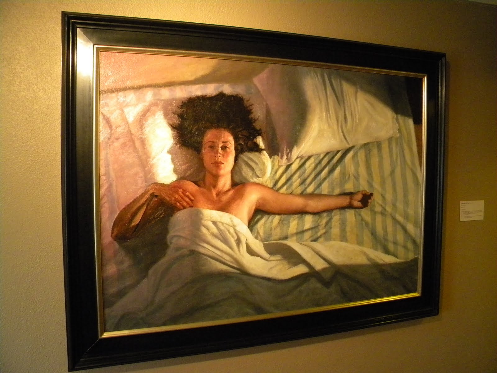 Sweet Sixteen by Christian Vincent, The Citadelle Art Foundation, Canadian, Hemphill County, Day 196
. . .
. . .
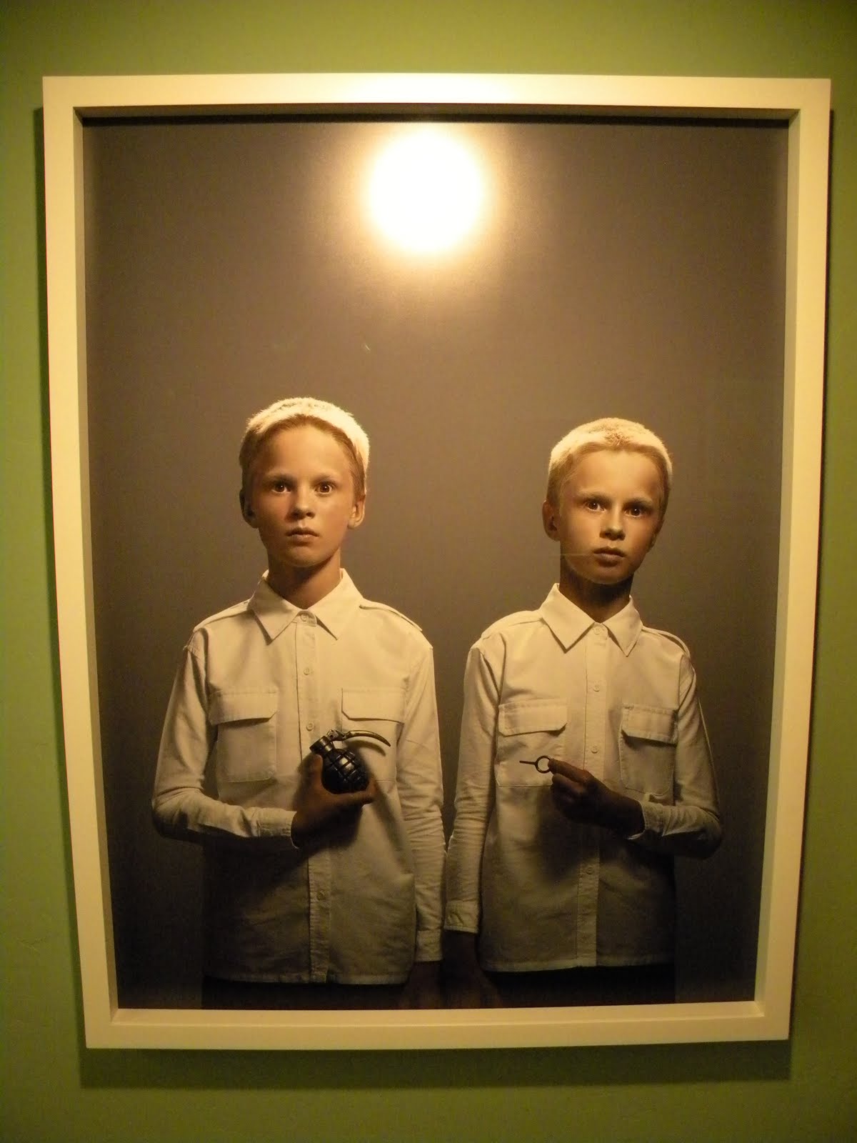 Twins by Jono Rotman, The Citadelle Art Foundation, Canadian, Hemphill County, Day 196
. . .
Day 196: On the way met Tray Webb, brother of Dawn; he stopped and shook my hand ... When I finally reached Marvin Lake, I met Sue again from the art museum! She offered me a night in; I accepted ... had some really nice conversations with Sue and Lonnie Cox, both in the ranching business.
. . .
Day 198: In Lipscomb. Tiny place. Staying at Naturally Yours thanks to Debby and Jan.
 High Plains Recycling, Lipscomb County, Day 199
. . .
Day 199: I met Boone Tyson of Tyson Ranch. He was youngish, red pick-up, backward cap. I complimented the panhandle, and he said simply "It's home." We chatted a bit, then he took off. In leaving he said, "I will be praying for you."
.
Before meeting Boone, I met another man who stopped to see if I needed a ride. But there was more. He invited me to a meal and a prayer group. I turned all three down. I tried to explain I was in the middle of a project, but he couldn't hear me where his mind was. I thanked him, and he took off. Later, he passed with his wife and daughter and offered again, this time only mentioning the food. I declined, smiling. They looked like they were ready to adopt me.
.
The difference between these encounters is stark. Boone asked my name, gave me his, and shook my hand. We were equal. The other fellow just saw me as a bum to be saved.
. . .
 The Panhandle's Top-Right Corner, Lipscomb County, Day 201
. . .
Day 201: Woke up near corner; hopped fence and found marker. [Back in Follett, everyone was asking me about the marker. Men who'd lived there their entire lives had never seen it. My little expedition got them all excited about it.]
. . .
 Going Rates, Booker, Lipscomb County, Day 202
. . .
Day 203: Frost again! Everything covered. ... Hiked into Perryton; scared up several pheasants and rabbits; took a lot of breaks, too; problem? ... I went to the library and posted a blog; bought a book by Plato for 25 cents; wisdom is cheap. [Donnie Dendy, whom I met in Lipscomb, put me up in his future home this evening.]
. . .
 Key Heights Baptist Church, Perryton, Ochiltree County, Day 204
. . .
Day 204: Wild goose chase; in Perryton trying to find my old pastor's old church before he came to Corpus; First Baptist Church was a bust; the secretary was scared even. ... Accidentally found Donnie at a restaurant with two women; one had known of my old pastor, so I was able to find the above church!
. . .
 Batman Grains, Ochiltree County, Day 204
. . .
Day 205: Nice night under a warm Ecuadorian wool blanket. [For two evenings, I was hosted by Mike Ladd of Waka. He's a former Peace Corps Volunteer, so we exchanged a ton of stories. The blanket was a Peace Corps byproduct.]
. . .
 Windmills, Spearman, Hansford County, Day 206
. . .
Day 206: Walked to a small canyon; Bud the dog followed me from a few miles back. [Several dogs have followed me along my trek, for a mile or two or three. Most turn back after a bit, but Bud stayed true. At my campsite, he dug up a rat for dinner, ate it and puked it up in the middle of the night. Bud stayed with me underneath my tarp, growling from time to time throughout the night. In the morning, I gave him some jerky, called his number on his tag, and his mom came and picked him up. She told me that collies can be very protective.]
. . .
 My First Snowman in Texas, Hansford County, Day 206
. . .
. . .
 Grandpa's Tree, Hansford County, Day 208
. . .
. . .
 Target Practice, Sherman County, Day 208
. . .
. . .
 Five Miles to Go, Sherman County, Day 210
. . .
. . .
 Bloody Toe, Sherman County, Day 210
. . .
Day 210: I'm getting the homeless vibe again. My waitress could hardly keep a straight face, part giggly, part embarrassed. Ah, to be known... [I had camped out in the snow and wind, so I probably didn't look too great. Take my feet, for example. I walked into Stratford in the shoe you see above. My toenail on my foot had buckled to the pressure of walking everyday. As a result, I bled a lot, straight through my sock and shoe. I later went to a laundrymat and washed the whole thing.]
. . .
 I'm Sure You Will, Stratford, Sherman County, Day 210
. . .
. . .
 Where the Antelopes Play, Rita Blanca National Grasslands, Dallam County, Day 211
. . .
Day 212: Wind! The wind actually started last night as I was settling in; lasted all night and all day. Tore apart my tarp in different spots. Wrecked the Hilton [My tarp set-up had been extra-spacious that evening, and I called it the 'Hilton.'], though the stakes held. Stayed in bed till 10:30am!
. . .
 The Builder, Dallam County, Day 213
. . .
Day 213: [The above was on an abandoned well in the Kiowa National Grasslands in New Mexico, just north of Texas in the northwest of the panhandle. I was looking all over for that corner marker and stumbled upon this well. It is nowhere near the corner, but what a neat thing to see.]
. . .
 The Panhandle's Top-Left Corner, Dallam County, Day 213
(Close-up below)
. . .
. . .
 41.19 Feet to Corner, Dallam County, Day 213
. . .
. . .
 The Other Marker, Dallam County, Day 213
(Tri-State Marker of Texas-Oklahoma-New Mexico)
. . .
. . .
 Sunset on the Top of Texas, Dallam County, Day 213
. . .
. . .
 Dalhart Consumers, Dalhart, Dallam County, Day 215
. . .
Day 215: Finally made it Dalhart. After meandering with a pint of ice cream in hand, I made it to downtown and met my couchsurfing host Nate French. I also met his dog Mr. Lambert who was wearing a glittering collar and a blue shirt that read Cool Pups in sequins. We talked, I cleaned up, and we went out to eat. Nate also gave me an impromptu tour of the town. ... Great host, great guy, nothing but helpful and nice and giving.
.
Day 220: In trying to find Randy's yard [where I was going to be camping for the evening], I met Pastor Tim Hooten. He let me use his computer to post a blog. We talked quite a bit. He would frequently go into sermon-mode, but it wasn't so bad. He gave me a Bible and prayed for me. "God, this is my new friend, Matt." I smile at that.
. . .
 Billy the Kid's Old Hangout, Oldham County, Day 221
. . .
. . .
 Farming the Wind, Oldham County, Day 222
. . .
Day 222: Phyllis from Gruver gave her son Scott Atwood the heads up that I'd be going through Vega. I met his wife at the grocery store, and we chatted. A little bit later, I met Scott at the Shell station. We talked a little bit, then parted amicably. [I went to the Shell station, bought a shower, and cleaned myself up. When I came out, there was a note in my backpack inviting me to stay at the Atwood's house!]
. . .
 Alex Jones Supporter, Oldham County, Day 223
. . .
Day 223: [If you're not familiar with Alex Jones, you may want to know in advance that he means what he says and says what he means. I read an article about him in Texas Monthly, I believe. He's tagged as a conspiracy theory fellow, but he backs his stuff up with quotes. The article was compelling, and to some degree, so was the man himself.]
. . .
 Short Circuit, Dallam County, Day 223
. . .
. . .
 Midpoint Self-portrait!, Adrian, Dallam County, Day 223
. . .
Day 223: Went to Adrian; MID POINT. I ate a burger and fries and two slices of pie at the Midpoint Cafe! [I was in the vicinity of my midpoint, having certainly traveled the requisite 1421 miles, so I celebrated big. The burger and pie were amazing.]
. . .
 Carpe Diem, Adrian, Dallam County, Day 223
. . .
. . .
 Old Bull, Deaf Smith County, Day 224
. . .
Day 224: [Didn't journal about this bull, but I liked this guy. When you're walking, cows will come up to you in a herd, wondering if you've got food. The quickly figure that you don't and stamp away in a cloud of dust.
.
This old bull didn't budge an inch. I had picked up two dogs which the bull eyed warily. Didn't seem in the least bit interested in me, to tell the truth. I was able to snap several shots while he watched the dogs scamper around, but I was careful to stay clear of those horns.]
.
Day 225: Started talking to an old man in a jeep. Very friendly fellow named Mr. Rucker. We were chatting about his family when another vehicle pulled up and the driver got out. It was Sandy Drake of Waka, Texas! She had been to a quilting fair in the area and brought me cookies, Nature Valley snacks, and a book with a letter in it! Incredible!
.
Day 228: Turned phone on and chatted with John Mark Beilue of the Amarillo Globe-News. He has my ideal job - full-time columnist! We talked while I walked. [Note: nature called at the same time, but I was able to accommodate both.]
And with that, I leave you! I hope I have appeased the photo hounds.
.
Until we meet again...
